
Shutterstock.com/Martin Lehmann
305.4 miles:
6 hours,
23 minutes
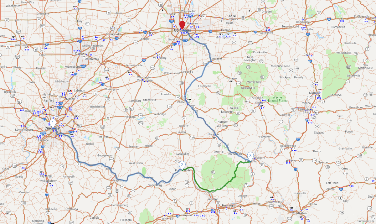
You’ll take interstates out of Cincinnati, and beyond the city the route is marked by portions of great open expanses as well as stretches entirely surrounded by trees. US 52 (also called Ohio River Scenic Byway) follows along the river that forms the Ohio-Kentucky border. The water isn’t visible the entire time, but when it is in view, it’s quite the sight to see.

flickr/Joseph
1
Cincinnati to Portsmouth
114.2 miles:
2 hours,
21 minutes
You’ll take interstates out of Cincinnati, and beyond the city the route is marked by portions of great open expanses as well as stretches entirely surrounded by trees. US 52 (also called Ohio River Scenic Byway) follows along the river that forms the Ohio-Kentucky border. The water isn’t visible the entire time, but when it is in view, it’s quite the sight to see.

Shutterstock.com/MaZiKab
2
Portsmouth to Gallipolis
69.8 miles:
1 hours,
44 minutes
US 52 continues on this leg. Railroad tracks parallel the road for a while, and if you’re lucky, some trains may accompany your journey. At Ironton the route veers off the Ohio River path and heads northeast toward a section through Crown City Wildlife Area; be on the lookout for deer and turkeys.

Getty Images/Jeremy Woodhouse
3
Gallipolis to Columbus
121.4 miles:
2 hours,
18 minutes
Stop at Gallipolis City Park, a pretty place to see close-up views of the Ohio River, before venturing out. Agricultural scenes take over in Fairfield County as crop fields line portions of SR 159/US 22 (between Kingston and the junction of US 33). And of course the surroundings change drastically once you approach and enter downtown Columbus, Ohio’s capital.
