
Kenneth_Keifer/iStockphoto.com
106.3 miles:
3 hours,
27 minutes
Much of this leg is in Cuyahoga Valley National Park. The tree-lined roads run along the Cuyahoga River, Ohio & Erie Canal Towpath Trail and Cuyahoga Valley Scenic Railroad. Pull off Riverview Road to watch wildlife from the boardwalk at Beaver Marsh. The outdoors scene changes to a lively urban one in downtown Cleveland: city buildings and sports arenas.

flickr/Raymond Wambsgans
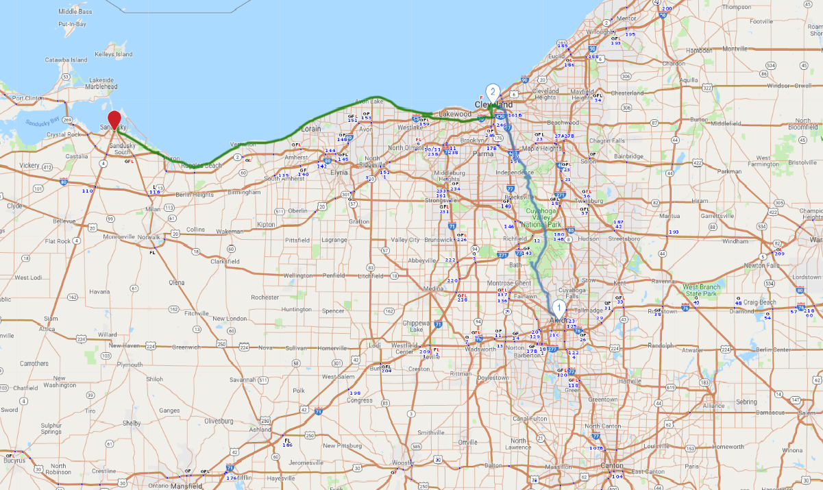
1
Akron to Cleveland
40.1 miles:
1 hours,
25 minutes
Much of this leg is in Cuyahoga Valley National Park. The tree-lined roads run along the Cuyahoga River, Ohio & Erie Canal Towpath Trail and Cuyahoga Valley Scenic Railroad. Pull off Riverview Road to watch wildlife from the boardwalk at Beaver Marsh. The outdoors scene changes to a lively urban one in downtown Cleveland: city buildings and sports arenas.

Greater Cleveland Aquarium/Dale McDonald
2
Cleveland to Sandusky
66.2 miles:
2 hours,
2 minutes
Once the city is in your rearview mirror, you’ll start seeing beautiful homes and neighborhoods along much of SR 2/US 6. Picture small-town America. At points along the route, Lake Erie will pop in and out of view between the houses and trees.
