
Route 66 - Eastern California Road Trip
Road Trip
View on Map
Shutterstock.com/Ysbrand Cosijn
262.3 miles:
5 hours,
7 minutes
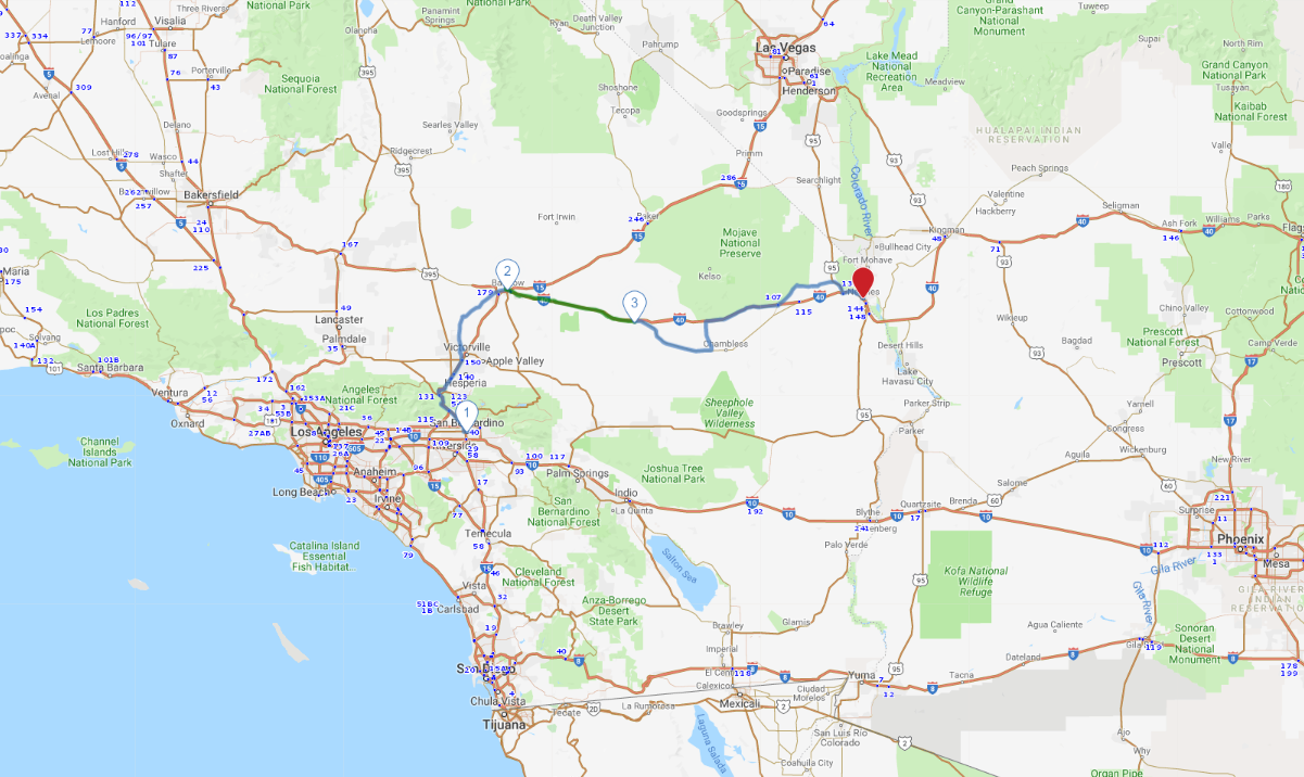
San Bernardino, the final locale name-checked in the song “Route 66,” kicks off the drive. Climbing into SoCal’s high desert you’ll drive busy I-15, then cruise two-lane National Trails Highway (formerly Route 66) before arriving in Barstow, which offers a handful of worthy attractions and some nifty Mother Road history.

Shutterstock.com/spirit of america
1
San Bernardino to Barstow
79.8 miles:
1 hours,
43 minutes
San Bernardino, the final locale name-checked in the song “Route 66,” kicks off the drive. Climbing into SoCal’s high desert you’ll drive busy I-15, then cruise two-lane National Trails Highway (formerly Route 66) before arriving in Barstow, which offers a handful of worthy attractions and some nifty Mother Road history.

Shutterstock.com/Bradley Allen Murrell
2
Barstow to Ludlow
67.3 miles:
1 hours,
27 minutes
A stone’s throw from Barstow is Newberry Springs, a speck in the desert that attracts European tourists thanks to its starring role in the German cult film “Bagdad Café.” From here, Route 66 runs alongside I-40 to Ludlow, once a railroad boom town that today amounts to a pair of gas stations, a diner and a few ghost town buildings from the route’s heyday.

Shutterstock.com/Sierralara
3
Ludlow to Needles
115.1 miles:
1 hours,
57 minutes
Leaving Ludlow, a lonely stretch of old 66 leads past an extinct cinder cone (Amboy Crater) to tiny Amboy, home to an iconic Route 66 café. The road proceeds to the north side of I-40, where the beautiful Mojave National Preserve warrants a detour. The drive ends in the city of Needles, which harbors a few roadside reminders of the Mother Road’s golden age.
Recommended Stops

BEST WESTERN Colorado River Inn
2371, Needles Highway Needles, California 92363
Book Now
