
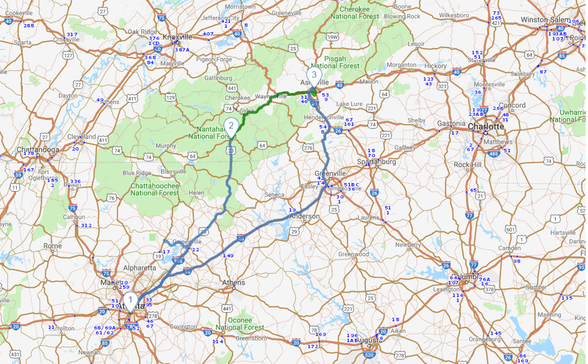
Mountains of Georgia and North Carolina
Road Trip
View on Map
iStockphoto.com/Laura Clay-Ballard
457.8 miles:
9 hours,
18 minutes
With Atlanta’s skyscrapers in your rearview mirror, head for the hills of northeast Georgia and western North Carolina on this scenic route. You’ll get a taste of the Blue Ridge Mountains—and their signature bluish haze—while passing through quaint mountain towns and gorgeous national forests on the way to Asheville.

Shutterstock.com/JayL
1
Atlanta, GA to Franklin, NC
165.7 miles:
3 hours,
18 minutes
Once you’ve conquered traffic in downtown Atlanta, it’s mostly billboards and views of the suburbs along I-85 and I-985 until you reach Gainesville, where the landscape gets noticeably hillier. You’ll begin to see mountains on the horizon near the turnoff for US-23 N/US-441 N. Stretch your legs in Dillard before crossing the North Carolina state line.

Shutterstock.com/Fotoluminate LLC
2
Franklin, NC to Asheville, NC
80.3 miles:
2 hours,
4 minutes
The route from small town Franklin winds through the Nantahala National Forest, crossing over creeks and under the Blue Ridge Parkway before making an eastward turn toward Asheville. Plan to spend a whole day exploring Asheville, where trendy restaurants, historic attractions and outdoor adventures await.

Courtesy of North Carolina Arboretum
3
Asheville, NC to Atlanta, GA
211.9 miles:
3 hours,
55 minutes
Your return journey cuts through the mountainous northwest corner of South Carolina, marked by plenty of recreation opportunities and greenery. Look for signs for Jones Gap State Park, which provides access to waterfalls, hiking trails and fishing spots. The route skirts Greenville before turning back toward Atlanta on I-85.


