
mushakesa/iStockphoto.com
203.4 miles:
6 hours,
29 minutes
You’ll take in Tarpon Springs’ Greek heritage as well as waterfront views along US 19A before a scenic trip over the Clearwater Memorial Causeway. Stretch your legs in tranquil Sand Key Park, then continue along resort-lined Gulf Boulevard. The inlet provides an emerald backdrop south of Indian Rocks Beach, before the road gets busier through St. Pete Beach.

AAA Images
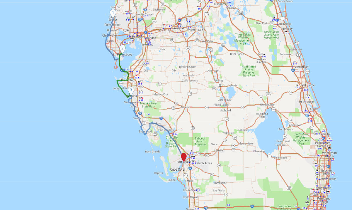
1
Tarpon Springs to St. Petersburg
49.4 miles:
1 hours,
53 minutes
You’ll take in Tarpon Springs’ Greek heritage as well as waterfront views along US 19A before a scenic trip over the Clearwater Memorial Causeway. Stretch your legs in tranquil Sand Key Park, then continue along resort-lined Gulf Boulevard. The inlet provides an emerald backdrop south of Indian Rocks Beach, before the road gets busier through St. Pete Beach.

DelmasLehman/iStockphoto.com
2
St. Petersburg to Sarasota
60.3 miles:
1 hours,
41 minutes
The Sunshine Skyway Bridge offers a birds-eye view of Tampa Bay en route to Bradenton. This leg connects charming Anna Maria Island—boasting large public beaches and a rustic city pier—to luxurious Longboat Key and its elegant resorts. Just before crossing Sarasota Bay, you’ll pass through the exotic shopping and dining district of St. Armand’s Circle on Lido Key.

fallbrook/iStockphoto.com
3
Sarasota to Fort Myers
93.7 miles:
2 hours,
54 minutes
Today’s itinerary includes Sarasota, home to Casey Key and its historic swing truss bridge; and Manasota Key, whose tropical tree canopy adds a whimsical touch to the beachfront road. Just before Fort Myers, the waterfront lifestyle along the Peace River in Charlotte Harbor and Punta Gorda comes into view.
